urban planning

Recalling Lake Ontario’s lost edge with steel and grass by stephanie calvet

A version of this post appeared in the October 10th edition of The Fort York Foundation's website. For more information, see www.fortyorkfoundation.ca/. The much-anticipated Fort York Visitor Centre is now open – to positive reviews.

The long, linear building recreates the lakefront bluff that defined the Fort’s 19th century geography and has taken root below the hulk of the elevated Gardiner Expressway. Its main exterior façade is composed of a sequence of monolithic weathered steel panels and a ”liquid landscape” of meadow plants, aligned with the contours of the original shoreline. The Visitor Centre inhabits the space behind this industrial escarpment, partially buried under the Commons. It is an ingenious approach to working with the landscape as a form of historical narrative.

Forecourt space will be planted in tall grasses with boardwalk circulation routes, recalling the original lakeshore landscape. Photo by Stephanie Calvet.

The building is a joint project by Vancouver's Patkau Architects and Toronto-based Kearns Mancini Architects – the result of an international competition held in 2009.

There is a remarkable similarity between the winning competition drawings and the final building. This is rare. Although the project underwent a comprehensive value engineering process, the original concept was not diminished nor was a more conventional approach to design taken.

Conceptual Sketch of the steel escarpment. Image courtesy of the project team.

The ‘fortified’ edge of the site is defined by steel panels. Photo by Stephanie Calvet.

Fort York Visitor Centre winning competition drawings - Perspective

The most significant change was in the superstructure –the "Ghost Screen"– a self-supporting layer that proved to be expensive and difficult to turn into an implementable piece of construction. Without compromising the essential imagery, the screen is (re)presented instead as a semi-translucent cast glass channel wall, which defines the building's uppermost volume along its length. “We decided to get more pragmatic about it”, says Patricia Patkau. “I think in some ways the project may have benefitted from that.”

A very rich landscape idea was presented as part of the winning submission, reflecting the historic harbour and telling the story of the site. Budget constraints, however, made certain key features undeliverable. These enrichments can be added as more funding becomes available.

Fort York Visitor Centre –Transversal section through the building and site.

To complete the weathered steel façade, an additional 37 inclined panels need to be installed. This extension of the wall from the east end of the Visitor Centre would demonstrate how the natural escarpment contributed to the Fort’s defences. As part of the liquid landscape, expanses of softly moving grasses will continue all the way along this steel edge, creating the illusion of the lake that, until the 1850s, came right up to the Fort itself. A series of illuminated raft-like objects and boardwalk circulation routes will help recall the former presence of the lake.

The full master plan also calls for a large terrace –"Events Dock"– reaching out into the liquid landscape. This will be the site for a slew of activities and here, at its highest elevation 20m up, the massive concrete and steel overpass will act as a huge covered canopy. (Just this past weekend, it was the site for a video installation during Nuit Blanche.) Imagine art installations hanging from its underbelly, and space for theatre, for concerts, and for kids to play. This is where the Fort York National Historic Site welcomes the modern city with diverse large-scale public events.

The new urban plaza will transform the previously derelict and underused space into a bright, new, urban neighbourhood amenity. Photo by Stephanie Calvet.

Fort York Visitor Centre winning competition drawings - Perspective

“There is a long list of enhancements that are not essential to the scheme but will make it richer. We hope that, over time, they can be phased in,” says John Patkau. After all, these details are the elements that we interact with most closely – they are the parts we see and touch.

The main façade of the visitor centre recreates the original escarpment and presents a strong elevation along Fort York Boulevard. Photo by Stephanie Calvet.

Fort York Visitor Centre winning competition drawings – South Elevation

The building is the result of a collaborative partnership between two innovative firms. It is not always obvious how two design firms can act as a team. In this relationship, there was no ‘master sketcher’, no single person taking the lead. The idea of the architect as solitary genius is outdated. Instead, it was a discussion, a conversation at all stages. “It's two complimentary, compatible design firms that are able to work together”, says Jonathan Kearns. “It’s almost like having a built-in peer review. We have a shared understanding and common goals." Toronto-based landscape architecture firm Janet Rosenberg & Studio was also an important part of the discussion.

The Fort York Visitor Centre will help Torontonians engage in the history of this site and the city. The designers, City of Toronto Culture, and community partners are committed to seeing some of the important missing elements that were described in the competition come to fruition. It’s just a question of when. The Fort York Foundation will continue to campaign and will need your support to realize this vision.

The canopy of the Expressway produces a huge, covered urban space for community events and programming. Photo by Stephanie Calvet.

The project's main façade is intimately interwoven in alternations of transparency and solidity. Photo by Stephanie Calvet.

Stephanie Calvet is a Toronto-based architect and writer specializing in architecture and design. For over a decade she worked in architecture and planning firms in Boston, designing projects in the hospitality, multi-unit residential, education and healthcare sectors. In addition to consulting, she writes for the popular press, trade publications, corporate organizations, and academic journals.

An Urban Forest: June Callwood Park Opens in Toronto by stephanie calvet

A version of this post appeared in the October 6th edition of UrbanToronto. Shadowlands Theatre performers take visitors on a journey through June Callwood Park. Photo by Stephanie Calvet.

There’s a new kid on the block. And it’s kid-friendly too. On Saturday October 4th, Fort York neighbourhood residents and those from beyond gathered to welcome a much-anticipated public space at its heart: a new urban park with a richly varied forest and striking pink covering. June Callwood Park injects colour and a dose of street life into the urban landscape.

The festivities celebrated the opening of the park and the legacy of June Callwood, one of Canada’s leading social activists who passed away in 2007. Coinciding with the kick-off of the all-night art crawl Nuit Blanche, City of Toronto officials in partnership with the Garden Club of Toronto welcomed the gatherers. Following a short speech by Callwood’s daughter, author Jill Frayne, and an appropriately floral ribbon-cutting ceremony, local art group Shadowlands Theatre engaged the crowd in a performative experience, leading visitors through an interactive tour of the park’s features.

Exploring The Maze with Shadowlands Theatre performers. Photo by Craig White.

The park is located amidst a quadrant of tall condo buildings on a wedge-shaped corridor spanning from Fort York Boulevard to Fleet Street. It is a key element in reconnecting the Fort to the Lake Ontario shoreline, which has incrementally moved south with infilling over the decades. The area has seen rapidly increasing residential density —including a growing number of kids— and, most recently, has garnered additional attention with the unveiling of the Fort York Visitor Centre.

Dedicated in 2005, the new 0.4-hectare park honours Callwood’s role in the development of social aid organizations and her fervent championing of children’s causes, through its design and art installation. The design, by Toronto-based multidisciplinary firm gh3, was the result of an open, two-stage international competition, which included extensive public consultation led by the City’s Parks, Forestry and Recreation division.

Landscaped site plan of June Callwood Park. Image courtesy of gh3.

It was a visual representation of the words of Callwood that formed the basis of the winning design. During one of her final interviews she was asked if she believed in God or in the afterlife. Her response, “I believe in kindness,” is a physically mapped voiceprint whose undulations create a path running north to south through the park, with an abstract geometric pattern of clearings within the groves. It is a contemporary urban vision of a park and garden.

The $2.6-million park includes an ephemeral reflecting pool, granite paving and benches, pole lighting, classic wooden park benches painted pink, and bright pink rubberized benches and surfacing. The forest is planted with over 300 trees, including plantings of native Canadian tree species, a sampling of the specimens that would have dotted the shoreline at the time the area was settled.

The starting point of the design takes a voice sampling of Callwood’s own words physically mapped onto the site. Image courtesy of gh3.

The park is loosely divided into six clearings, each with its own unique spatial character: the Puddle Plaza is made up of depressions that collect rainwater to create splash pads; the Ephemeral Pools act as a splash pool in the summer and a mist garden in the fall; a hedge Maze; the Pink Field boasts a wide rubberized play surface; the Puzzle Garden features a series of maze-link benches; and, the Time Strip Gardens borrow from a variety of native landscape and European settlement themes. A lone apple tree —the Callwood Tree— stands at the point where all of the park's paths converge. The park is a series of gestures that reads at the neighbourhood scale, and at the human scale.

View northward through June Callwood Park. Ephemeral Pools at the forefront. Photo by Stephanie Calvet.

Granite pavers, trees, plantings, and fine gravel at June Callwood Park. Photo by gh3.

Callwood had envisioned this park for toddlers and their caregivers. The new park’s spaces are open to a broader array of experiences and ageless activities that could range from tai chi by the mist garden, hide-and-seek in the maze, and lunch among the poplars. There is no grass. The cushioned rubberized surfacing in bright pink makes for an especially inviting playground for kids.

As a complement its sound-inspired layout, the park integrates a permanent sound installation – Toronto’s very first – by Douglas Moffat and Steve Bates of Montreal who work together as soundFIELD. The artists derived the concept for the innovative sound work, entitled OKTA, from Callwood's own experiences of gliding through the clouds: "Flying is like entering another dimension where your body becomes flexible and gravity lets go. I once flew through a cloud - I thought it would be warm and fluffy, but it was ice cold. In the sky there are always discoveries," said Callwood.

OKTA is an installation where multiple points of sound are distributed across the site.

A sensor aimed at the sky reads current cloud cover. The shifting shape and movement of clouds overhead triggers the sounds released across a field of 24 sculpted sound-columns, creating an ever-changing experience for the listener.

Good planning ensures good interaction between public space and the diverse nature of public life. The site, which until recently sat empty, was revitalized using open space as a physical framework and shifts from being a transit street to a destination. By inviting social, recreational and meditative activities, Fort York’s new neighbourhood park creates space to foster positive relationships and healthy lifestyles while also providing long-term environmental benefits.

The rubberized Ure-Tech surfacing is soft, anti-slip, self-draining, and accessible. Photo by Stephanie Calvet.

Snippets from the evening can be seen below.

http://www.youtube.com/watch?v=yoZRppxxIxQ

Stephanie Calvet is an architect and a writer specializing in architecture and design. She can be found at www.stephaniecalvet.com

Toronto's Fort York Visitor Centre Opens by stephanie calvet

A version of this post appeared in the September 19th edition of UrbanToronto Entry to Fort York Visitor Centre, framed by a weathering steel panel façade. Photo by Stephanie Calvet.

The Official Opening of Toronto's Fort York Visitor Centre was held today. By most definitions, the city’s newest attraction, which is embedded into the ground, makes a bold statement whilst being minimally intrusive. The project is the result of a collaborative partnership between two design firms, Patkau Architects, an innovative studio based in Vancouver, and local associate architects Kearns Mancini.

"Right from the beginning, my feeling was that it could not be a little building sitting here because it would just look trivial beneath the Gardiner,” says architect Patricia Patkau. “Somehow it had to take on a different persona, like a landscape. It needed to be something of great scale, but without the height.”

Fort York Visitor Centre below the Gardiner Expressway. Photo by Stephanie Calvet.

The north façade of the Fort York Visitor Centre with the Gardiner Expressway above and behind. Photo by Stephanie Calvet.

Built in 1793, Fort York, now a National Historic Site, is known as the location where the Battle of York came to its violent climax in 1813 during the War of 1812. Today it is home to one of the oldest collection of fortifications in Canada, enclosing the country’s largest collection of 1812-era military structures within its defensive walls. Where the Fort is powerful in its history, it is not in its physical presence. Characterized by low-lying buildings, on a site landlocked between roadways and rail corridors, it has been almost invisible to passersby. Many Torontonians are not even familiar with its existence.

The Visitor Centre now changes this balance. Located on Fort York Boulevard, almost immediately below and just north of the elevated Gardiner Expressway, it acts as both a gateway and an interpretative hub for the entire 43-acre Fort York National Historic Site, considered the birthplace of Toronto. The new building is itself a key component in the ongoing restoration and revitalization of the city’s founding site, which includes not only the seven acres within the Fort's walls but also the archaeological landscape, Garrison Common, Victoria Memorial Square, the Fort York Armoury and Garrison Creek parkland to the east. For the architects, the building was not simply seen as a Visitor Centre but an opportunity to provide a sense of connection both historically and physically with other parts of the site.

The Visitor Centre's interpretive function is a key part of a plan to revitalize the entire 43-acre historical site.

The 27,000 square-foot Visitor Centre provides Fort York’s first secure exhibit space and enables the display of artifacts from the City’s collection that tells its 200-year story. Its green roof is an extension of the Common. Ground-embedding the building made it sustainable from an energy perspective and easier to develop as a Class A museum-quality interior: well insulated and unaffected by daylight. Toronto exhibit designer Reich + Petch also had a hand in shaping the environment, which includes a 2900 sq. ft. exhibit gallery; a climate-controlled vault designed to display iconic and light-sensitive artifacts; and, an Orientation Theatre. In addition to permanent and changing exhibits, it also provides facilities for education, research, staff and community use.

Fort York Visitor Centre Exhibit Gallery with 'The Vault' in the background. Photo by Stephanie Calvet.

Architects Jonathan Kearns and John Patkau introduce the Fort York Visitor Centre. Photo by Stephanie Calvet.

The Visitor Centre snakes along the base of the monolithic structure that looms above. It aligns with the original shoreline of Lake Ontario, now set back some 500m, altered by two centuries of infill. Lined by a series of inclined Corten steel panels, its main façade recalls the original lake bluff, which contributed to the Fort’s natural defences. The modularity of those weathering steel panels, in considerable 8’x24’ proportions, is broken by sections of glass at building entry points. An array of glazed slits between the panels, along the length of the building, allow thin segments of natural light to permeate the main reception area and sunken exhibition gallery.

The new Fort York Visitor Centre. Photo by Stephanie Calvet.

Entrance points to the new Fort York Visitor Centre. Photo by Stephanie Calvet.

The building’s workings are best illustrated in section. “This is sort of an ‘upside down’ landscape, in terms of its archaeology, where the visitor enters on a lower contemporary landscape and rises up into an archaeological landscape. It is an interesting inversion of how it usually happens. The history, then, is the upper landscape and the modern world is the lower landscape,” explains architect Johnathan Kearns.

Cross-section through the Visitor Centre. Image courtesy of Patkau Architects.

Longitudinal sections through the Fort York Visitor Centre. Image by Patkau Architects.

The procession through the building tells the story. The immersive "time tunnel", a digital media space along a gentle inclined plane that zigzags back, takes the visitor through a virtual re-enactment leading up to the Battle of York. When emerging out of the end of it, the visitor is directly facing the Fort itself, with the backdrop of modern-day Toronto. Visitors can then go forth and explore the Fort, armed with a deeper understanding of its background and an appreciation of its importance as a national historic site.

Existing Fort York site with Toronto's skyline beyond. Photo by Stephanie Calvet.

Hosted by The City of Toronto, The Fort York Foundation and The Friends of Fort York, the Opening Ceremonies began with fife and drum music by the Fort York Guard Drum Corps under the Gardiner Expressway. The musical prelude was followed by a welcoming and remarks by dignitaries, and then the ribbon cutting. On Saturday and Sunday, from 12 to 7pm, at the On Common Ground Festival, the public is invited to experience a free weekend of performances and exhibitions with culturally diverse music, dance, theatre, craft-making, kidzone, community village and local food. For a full schedule of events, please see link.

The Centre is open but not quite finished; visitors will find that several exhibits have yet to be installed, and most of the landscaping remains to be started, let alone completed. A number of enhancements will be added as more funding becomes available. In particular, the full master plan calls for the placement of an additional 37 steel panels to recreate the escarpment, and expanses of softly moving grasses recalling the waters of the lake. And the project team envisions the extension of a large terrace under the Gardiner that, here, at its highest elevation, will act as a covered canopy for a great diversity of public events. Still, there is much to see now, and celebrations continue.

The Gardiner shelters a huge covered event space. Image by Patkau Architects.

South elevation of the Visitor Centre, below the Gardiner Expressway. Image by Patkau Architects.

Stephanie Calvet is an architect and a writer specializing in architecture and design. She can be found at www.stephaniecalvet.com

Athletes at Home in Toronto's 2015 Pan Am Games Aquatics Centre by stephanie calvet

A version of this post appeared in the September 10th edition of UrbanToronto The Toronto Pan Am Sports Centre (TPASC) located at the University of Toronto Scarborough campus began operating this week. Under the official name “CIBC Pan Am/Parapan Aquatics Centre and Field House,” the venue is the largest sport new-build for the 2015 Pan American/Parapan American Games set to take place in July.

Co-owned by the university and the City of Toronto, the $205-million centre is the sole aquatics facility in the region that meets the latest international competition standards and represents the largest single investment in Canadian amateur sport history. It will play host to the Games’ swimming, diving, fencing, modern pentathlon, sitting volleyball and roller sports events.

The Toronto Pan Am Sports Centre. Photo by Stephanie Calvet.

The Organizing Committee (TO2015) and its partners set out to create an inspirational beacon for health and sport. Designed by NORR Architects of Toronto, the LEED Gold building provides “world-class” training facilities and a venue to host national and international competitions. It is also home to Canadian Sport Institute Ontario, which provides science and sport performance services to high performance athletes and their coaches.

But once the Games have concluded, the facility will become joint campus-community recreation space for university students and Scarborough residents to use and enjoy, while giving youth a place where they can train, play, gather and compete. “From our perspective as a university, we believe we can do a lot with community engagement. Many areas around here were former priority neighbourhoods with no facilities. The hope is that this centre attracts people, that they feel connected to a university and that it creates opportunities for them to set goals they might not otherwise have had,” says Andrew Arifuzzaman, UofT Scarborough Chief Administrative Officer.

Competition pool at the Toronto Pan Am Sports Centre. Photo by Stephanie Calvet.

The Aquatics Centre includes two internationally sanctioned 50-metre, ten-lane swimming pools; a warm-up pool; a 5-metre deep diving tank with 3-, 5-, 7.5- and 10-metre platforms; and dryland training facilities with dive pits and trampolines. It doubles the number of Olympic-sized pools in the Greater Toronto Area, which until recently stood at two. (By contrast, Sydney, Australia, a smaller city than Toronto, has 42). Adjusting the mobile bulkheads increases the versatility of the practice and competition pools, allowing them to be divided and programmed in multiple ways. In both, the acoustical hanging baffles on the ceiling were arranged such that the gaps between the panels align directly above the swim lines below, a small detail that provides a valuable reference point to help backstroke swimmers keep on course. The training pool, shown below, includes a 25 m2 movable floor area to provide a variety of shallow-water fitness activities and facilitate access for individuals with disabilities.

Training pool at the Toronto Pan Am Sports Centre. Photo by Stephanie Calvet.

One of multiple gymnasia in the Toronto Pan Am Sports Centre. Permanent retractable and temporary seating line the walls. Photo by Stephanie Calvet.

The Field House features flexible gymnasium space for training and competition, an indoor track, and a fitness area complete with the latest in cardio and weightlifting equipment. Among the building’s more high-tech features are a (section of) runner’s track with pressure sensors and motion-capture technology and state-of-the-art performance diagnostic tools. Add on the sport medicine mini clinic with its heat chambers and medical therapy rooms and you’ve got the best athletically endowed campus in Ontario.

Creating a sense of animation throughout the building was a key design driver. By using a high level of transparency in the interiors, the two primary corridors have been programmed as strong public spaces. Lined with glass, they overlook the centres of activity. The indoor climbing wall located just off the main lobby entrance contributes to the feeling of liveliness. There was a concerted effort to get young kids to see and potentially be inspired by elite athletes.

Climbing wall at the Toronto Pan Am Sports Centre. Photo by Stephanie Calvet.

Corner multipurpose studio for community dance classes, combative sports, ballet, and yoga. Photo by Stephanie Calvet.

The combination of building form and its glazed components combine to bring a sense of dynamism to the street, with exercise rooms radiating their creative energy, a combination of play and light. However the large facility has not overwhelmed the low-rise neighbourhood. The redevelopment strategy of the site required a complete remediation because it had been a brownfield. Excavating it gave the design team the opportunity to sink the building inside the hole, with benefits on two fronts: keeping the scale of the building within that of the existing context and bringing lots of indirect natural light into the spaces, eliminating glare on fields of play.

The Toronto Pan Am Sports Centre. Photo by Stephanie Calvet.

The TPASC is 100% accessible, exceeding Ontario codes and meeting London, UK’s stricter Standards for Accessible Design in every program area throughout the building. Since its inception, the University has been committed to becoming one of the most accessible universities in the world. This would be one element within the University’ mission, “to strive to create a respectful and inclusive environment that promotes opportunity and overall well-being through physical activity.” They have demonstrated this through the use of accessible washrooms and change rooms, fitness equipment that can be operated by someone in a wheelchair, the use of vertical actuation bars (in lieu of push plates), modesty panels, and washing stations to accommodate those with religious practices.

In addition to the investment in new facilities that are being constructed, there will be millions of dollars spent on the renovation and alteration of existing facilities for the upcoming Games. These buildings will serve as a lasting legacy as much-needed sport infrastructure for Canadian athletes to train and compete at home.

After the Games, the temporary (blue) exterior wall will be removed and replaced and the area will become covered drop-off. Photo by Stephanie Calvet.

Stephanie Calvet is an architect and a writer specializing in architecture and design. She can be found at www.stephaniecalvet.com

Creative Thinking Adapts a King West Commercial Building by stephanie calvet

A version of this post appeared in the August 12th edition of UrbanToronto Another adaptive reuse project has won out in Downtown Toronto. The modest building at 545 King Street West is being rehabilitated by Hullmark and will see new restaurants and offices occupy its five floors. It is a refreshing change from the tactics of some developers who, keen to maximize real estate values, can succumb to demolishing the historic fabric of the neighbourhood rather than considering the role adaptive reuse can play in the city.

The street has radically transformed in the past decade. Its potential was unleashed back in the mid-90s when changes to zoning allowed King-Spadina (one of the “Two Kings” reinvestment areas), once-restricted to industrial, to open up to new uses. Since then, King Street W has been flooded with award-winning restaurants, corporate headquarters, nightclubs and condo buildings. The spin-off effect since the planning policy was introduced has seen this creatively oriented and vibrant part of the city emerge as a highly desirable urban lifestyle community.

Sketch of proposed exterior graphics at 545 King St W, image courtesy of Quadrangle Architects

Originally built in 1921, with a rear addition completed in 1981, 545 King Street W is characterized by brick and heavy timber beam construction, once commonly found in the former Garment District. No drastic changes were made to the exterior in the Quadrangle Architects-led renovation. It is constituted of an updated façade treatment with new windows and sills, cleaned and repaired brickwork and the addition of graphics and material accents. Because of the building’s narrow proportions and the existence of windows on its side elevations, the designers were inspired to build on the idea of natural ventilation. Casements replace existing glazing, with coloured fritted glass emphasizing their operable function and animating the façades. “Our intention was a subtle augmentation of the building while maintaining the existing character to add a new layer of contemporary expression,” says Richard Witt, a principal at Quadrangle.

Existing building at 545 King St W, photo courtesy of Hullmark

Rendering of updated north elevation at 545 King St W, image courtesy of Hullmark

The interiors, however, are getting a major facelift. The building was stripped back to its exterior walls and bare floors and ceilings, which presented the architects with the opportunity to completely reinvent its spaces. Popular restaurants Pizzeria Libretto and Porchetta & Co. will open up secondary locations on the lower level, and a software company is to set up shop on the 5th. BrightLane, a co-working space for entrepreneurs and start-ups, will continue to occupy the remaining levels and its members have access to the 3rd floor roof terrace. The top floor has a 2-storey volume office space capped with a skylight.

Gutting of typical floor at 545 King St W, photo courtesy of Quadrangle Architects

A particularly interesting angle to the project is the revitalization of the dreary 153’ long by 12’ wide laneway immediately adjacent. It previously served a warehouse loading dock at the rear that the architects have transformed into the main commercial entrance and new ‘front door’. (The building’s existing ‘front door’ on King Street W becomes a convenience entrance for the upper levels.) The flanking laneway, once dedicated to deliveries, is converted to a pedestrian area with a restaurant patio and spill-out space from the new lobby.

Existing alleyway adjacent to 545 King St W, photo courtesy of Quadrangle Architects

BrightLane, the building’s primary tenant, hosted an ideas competition seeking inspiration from the public for ways to make the narrow, marginal space more appealing. “We’re looking for something interesting and sustainable that can be easily implemented,” said its General Manager, Susy Renzi. The call for submissions was made via video headlined 'Can you make this sad space AWESOME?' It drew over 180 entries from local and international creatives, whose ideas ran the gamut from forest oasis, outdoor market, and playgrounds for adults (with and without a giant waterslide).

The winning scheme proposes to brighten the space by suspending fragments of primary-coloured acrylic in wavy shapes above it. As the sun travels over the lane, coloured moving shadows are cast onto surrounding surfaces; the experience being equally evocative at nighttime, when illuminated by floodlights. The canopy of colour represents the energy and interdisciplinary environment that BrightLane fosters. The simple but dynamic concepts applied to the façades and laneway provide better visual connection into the building and extend the street life.

The winning submission from Brightlane's ideas competition will be implemented in Spring 2015

The difficulties associated with adaptive reuse can be a deterrent to many developers. Unforeseen discoveries on site – from mould to hidden fuel tanks – can have negative impacts on cost and schedule and the added complexities often require creative solutions. Despite the challenges, the benefits are multi-fold. Rehabilitated and repurposed buildings not only help meet city-mandated density requirements, but they contribute to the fabric of city life and the continuity of collective memory.

With a long-time specialty in retrofit and adaptive reuse, Quadrangle brings agility and nimbleness when working with existing conditions. A synergy clearly exists between the developer and the architects – this is, after all, the third collaboration of similar objective between them. “Hullmark understands that buildings like this have value and that value is worth working hard to unlock”, says Witt. Under the direction of Jeff Hull, Hullmark’s vision as city builders, previously known for their large residential developments, has taken a more urban focus and set its sights on high quality inner-city tenants. By renovating and turning a former warehouse into a vibrant employment and amenity hub, the building both reflects its history and becomes relevant to the future of King W.

Other than the alleyway installation, the 545 King Street West project is scheduled for completion this summer.

Stephanie Calvet is an architect and a writer specializing in architecture and design. She can be found at www.stephaniecalvet.com

Boston’s Greenway by stephanie calvet

On a recent trip to Boston – a city I once called home – I visited a series of linear parks collectively known as the Rose Fitzgerald Kennedy Greenway. Left by the razing of a former raised highway, the public spaces thread through the downtown core, re-stitching together neighbourhoods and providing visual and pedestrian connections that had been severed over half a century ago. Boston

Boston-2

Each segment within the Greenway has its own spatial vocabulary and character. Primary emphasis was placed on the public realm; the spaces are complete with promenades, plazas, landscaped gardens, recreational fields, sculptures, information pavilions, splash fountains and a carousel.

The Greenway is the most visible result of the 16-year project dubbed the Big Dig, one of the most ambitious feats of construction and urban design ever undertaken in a US city. For 50 years, the I-93, a rusting elevated six-lane roadway, slashed through downtown Boston. It separated the waterfront from the rest of the city and isolated the North End, running right through the middle of the business district on a great sweeping curved viaduct. (From my seat on the Green Line train, I could look directly into people's office windows.)

For 50 years, the Central Artery has sliced through the heart of downtown Boston. Photo courtesy of The Boston Globe.

The colossal endeavour saw the dismantling of a stretch of the I-93 and its rerouting within a 3.5mile tunnel buried beneath the city. The project faced every sort of challenge, from political and financial difficulties to environmental and engineering obstacles. But no one is looking back. With the massive barrier removed, the resultant green space, though flanked on both sides by a ground- level roadway, reunites neighbourhoods and acts as a crossroads for people travelling between them.

Greenway District Planning Study, image courtesy of Greenberg Consultants Inc.

The Greenway. Image courtesy of The Boston Globe.

Best of Boston

Boston-3

Boston-9

Best of Boston-2

For Torontonians, the Greenway illustrates the social and environmental benefits of the open space network and serves as an interesting example of what this city might do were it to take down the Gardiner Expressway (shown below). Toronto: Look and Learn!

The Gardiner Expressway is downtown Toronto's main commuter artery, cutting an elevated swath through the core. Image courtesy of the City of Toronto.

On the other side of Boston's Fort Point Channel, I checked out the Seaport District, a hotbed of construction and urban infill. The area has gone big with hotels, office buildings, and restaurants. Adjacent to it is the revitalized neighbourhood of Fort Point. New eateries have set up shop here but, you can still find artists’ studios and design firms holed up in its brick warehouses...

Boston-8

Best of Boston-3

Boston-7

ICA

Best of Boston-4

Best of Boston-5

Boston Strong

Manhattan's Hudson River Park by stephanie calvet

On a recent trip to NYC, I saw wonderful urban planning strategies at Hudson River Park. It offers a huge variety of recreational activities and landscaped public spaces throughout its 550-acre footprint and sets a useful precedent for the ongoing development of Toronto's waterfront. Canada's largest city's skyline has been rapidly changing, in part due to a blitz of condo construction. Guided by Waterfront Toronto, the city has spent billions to revitalize a once heavily industrial lakefront and transform it into beautiful and sustainable new communities and parks. Now a private entity is proposing to expand a small inner-city island airport on the waterfront through jet aircraft and extended runways, paving 500m into the harbour and Lake Ontario.

Below are images of Hudson River Park in NYC. I imagine what the area would look like with an airport disgorging thousands of passengers per day. I think of its impact on neighbouring communities and services, on cultural activities, and on the quiet enjoyment of the waterfront by citizens and visitors alike. Alarming.

Manhattan

Manhattan-2

Manhattan-10

Manhattan-2-2

Manhattan Waterfront

Manhattan-3-2

Manhattan-3

Public spaces like the High Line and the 9/11 Memorial grounds are well worth a mention, and a visit, as well.

Manhattan-11

Manhattan-4

The Freedom Tower

9/11 Memorial

Developer Ken Tanenbaum Talks about Toronto's Pan Am Athlete's Village by stephanie calvet

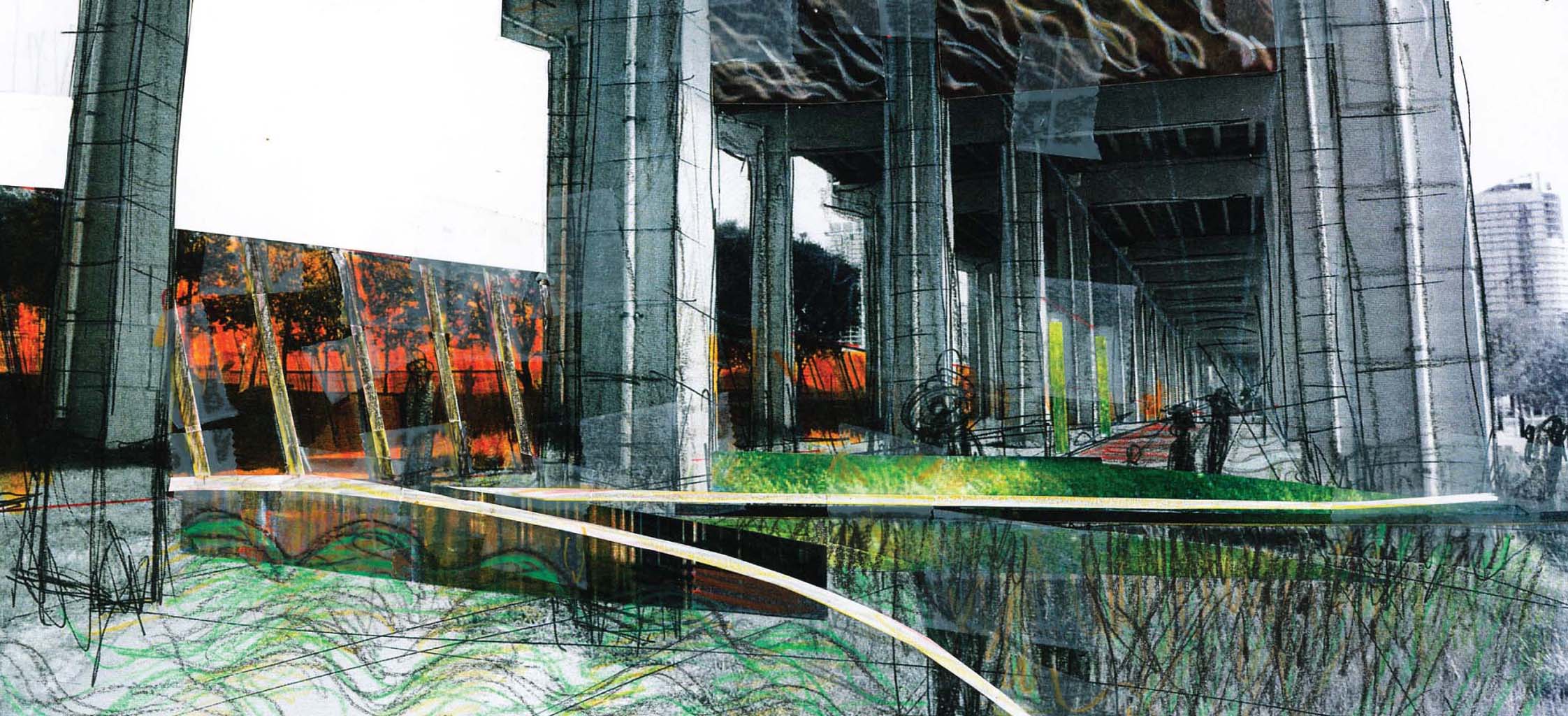
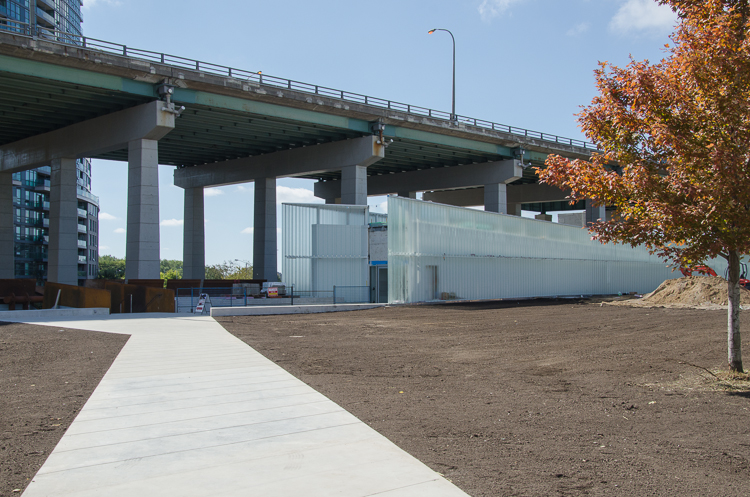
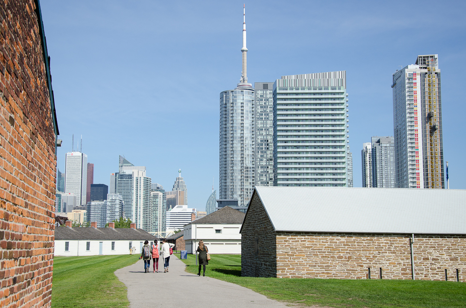
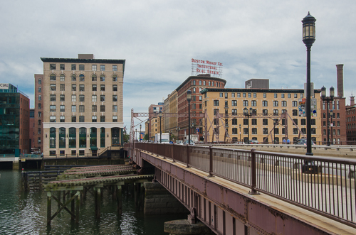
A takeaway from past Olympic Games’ host cities that spent big in a short burst of activity for the temporary event is a prescient reminder of the potential that well integrated planning for long-term transit and urban regeneration can bring. Toronto now has that same rare opportunity: the city is hosting the 2015 Pan Am/Parapan Am Olympics next summer. While it is relying on mainly existing infrastructure throughout southern Ontario for the sporting venues, an entirely new development is being built just east of downtown to house the 10,000 athletes and officials. I recently met with Kenneth Tanenbaum, Vice Chairman of the Kilmer Group to discuss the Athletes’ Village. Revitalization plans will transform the former industrial site into a mixed-use community with affordable housing, condominiums, a YMCA and a dormitory for George Brown College students, branded post-Games as ‘Canary District’.

A version of this post appeared in the June 30th edition of UrbanToronto.    

Site plan of 2015 PanAm/Parapan Games Athletes’ Village (Canary District)

Tell us how it is that Toronto is about to get a new Athletes' Village and then a new neighbourhood in this former industrial area at the mouth of the Don River.

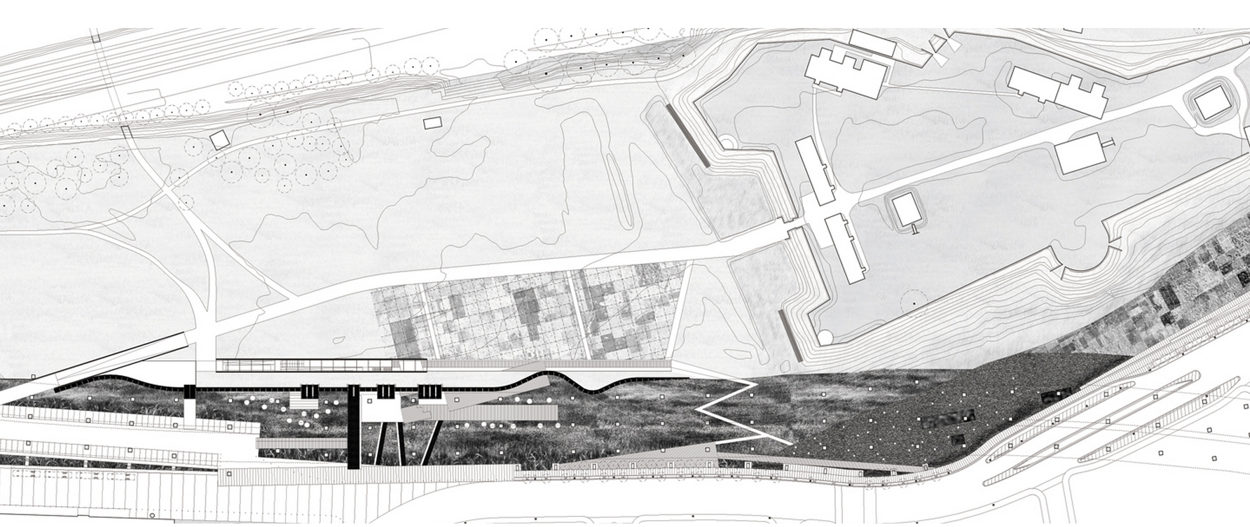
The genesis of the West Don Lands Pan Am Athletes Village and Canary District really begins with the government of David Peterson in the mid-1980s, which expropriated this land in the Downtown East with a view to allowing the city to grow in this direction. The market and environmental conditions of the site were such that the land sat derelict more or less for 25 years until a moment in time when forces converged with the Pan Am Games being announced, and Waterfront Toronto’s planning mandate was able to finally execute the vision that Peterson’s government had.

How did Dundee and Kilmer collaborate towards this proposal?

Kilmer has been in the heavy civil construction and materials business for three generations. I represent the third generation. I grew up in asphalt paving and aggregates and shifted towards engaging in public/private partnerships. Our firm, Kilmer Van Nostrand, has developed an expertise and set of core competencies in this area. We are not traditional real estate developers. Dundee, on the other hand, brings very deep experience in traditional real estate development. It was a very complimentary set of skills that brought us together and it was through that partnership that we’ve been recruited as the project delivery team.

We are very lucky because all the stakeholders are aligned to a single mission: deliver on time, on budget design excellence.

Kenneth Tanenbaum on the Canary District construction site, home to the Toronto 2015 Pan Am Athletes' Village

Big games bids run over budget in general. The demonstrations in Brazil are a current example. Given the background of cost overruns, what are your thoughts on best practices in cost management?

Infrastructure Ontario set up a procurement process that allocated risk properly between the public sector and the private sector. We worked with EllisDon and Ledcor to achieve a GMP or ‘guaranteed max price’ and there is significant skin in the game for those contractors if they are not delivering. DundeeKilmer’s objective is to make sure the team is marching together. Lots of tried-and-true building technologies were used here. We weren’t pioneers in anything.

What lessons have you taken from the 2012 London Olympics or 2010 Vancouver Olympics or other regeneration projects around the world?

Lessons were learned by spending time in Vancouver and interviewing people engaged in project delivery. Infrastructure Ontario, the procurement agency for the province, internalized those lessons and delivered a procurement model that I think set us up for success and which I believe represents a great export opportunity for other cities building Athletes’ Villages. It was an enormous undertaking to design, procure and finance a billion dollars’ worth of work in 90 days, which was the task we were given to do. We brought together a great team of designers, engineers, and contractors to do that.

Hundreds of lessons were learned from jurisdictions that didn’t have the right balance between private risk and public risk. What risks rightfully belong with the private sector? What risks should government continue to take? To Infrastructure Ontario’s credit, they came up with the right balance. I think Waterfront Toronto, insofar as planning was concerned, gave us a canvas on which to paint our architects’ view of the village. That was another important foundational piece for success – the precinct planning by Waterfront Toronto.

One of the areas where Vancouver where got off the rails is they were innovating in green building design. That’s all well and good and there are lots of green elements in our design as well but, when you have to spend $1M a day, everyday, you can’t be innovating or learning on a job site like this. You have to incorporate LEED best practices that are off-the-shelf. The right allocation of risk and the right team gets us to the right results.

The Pan Am Games is the largest event that this city has hosted and will host for a long time. It is a great opportunity for us to celebrate the great things about Toronto – a multicultural, pluralistic society, and a beacon on the planet. We have to tell a great story for Toronto. The Athletes’ Village is just one small element. It is part of the success story but it is not the story. The story is that we have 10,000 athletes and officials coming with their families from 41 countries who may at some point look at Toronto as a place to live, or invest but in the meantime they will be here spending dollars and going to restaurants.

Looking west on Front Street from Canary District to Downtown Toronto

Are you involved in creating any sports facilities?

No. Dundee Kilmer has only one mandate: to deliver the Athletes’ Village, on time and on budget.

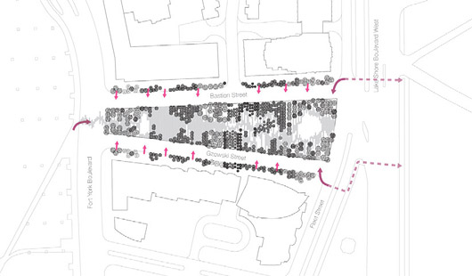
Pan Am does not only exist in the Canary District. There are many other areas. How do they connect up? Is there a master plan?

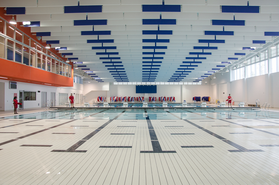
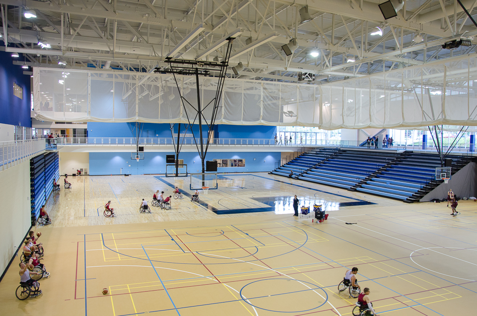
We are building something called the Transportation Centre south of Mill Street, on provincially owned land. It will be effectively part of the secured perimetre where buses will come in and out to move athletes from the Village to their games venues. The strategy of TO2015 was to have the Games be hosted by Southern Ontario so the venues are dispersed in Welland, Milton, Durham Region, Scarborough, and York University. That also enhances their legacy. All the sporting venues that are being used will have a post-Games life. Again, it is a lesson learned from other Olympic or multi-sport games where you have elements that become white elephants. You won’t have that here.

You’ve established some of the criteria for success. How will you know you’ve been successful?

I’ll know if the athletes aren’t sleeping in my basement! In all seriousness, success is an on-time, on-budget delivery of an Athletes’ Village in accordance with the IOC/Pan Am Games specifications. But, to me, the most important measure of success is in realizing a once in a lifetime opportunity to be a part of shaping Toronto’s next great neighbourhood.

Looking east from Canary District, Foundry building to the left.

What is there that exists already that drives momentum for that? Is it managing the overspill pressure from Downtown Toronto?

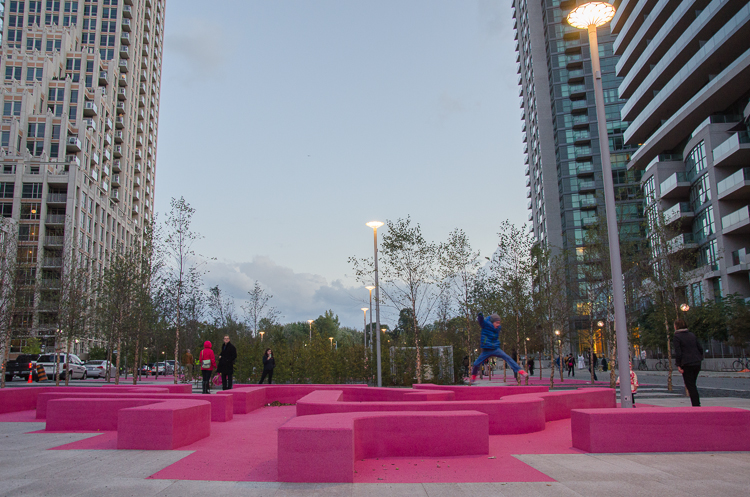
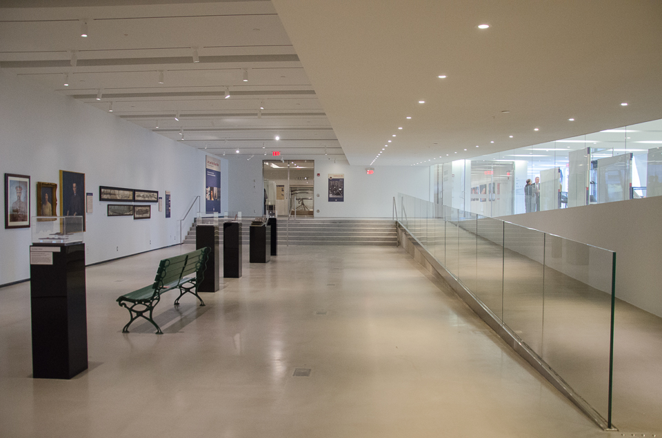
I think Toronto’s future really pivots on its ability to continue to attract 100,000+ migrants a year. How do we do that in an environment that is governed by provincial policy, Smart Growth, and Places to Grow (focused on intensifying the urban core), and do it in a way that does not lead to more traffic congestion and less liveable neighbourhoods? I think that Canary District really fits the bill in terms of Smart Growth: it integrates walkability, liveability, and transit. I think of the acronym HOME – housing, opportunity (jobs), medical care and education. A number of those elements are being built, or being planned. The YMCA will be an incredible amenity for this neighbourhood in addition to the public realm that really serves as outdoor therapy, which is vital for a healthy city.

You have chosen Canary District as the post-Games residential brand for the area.

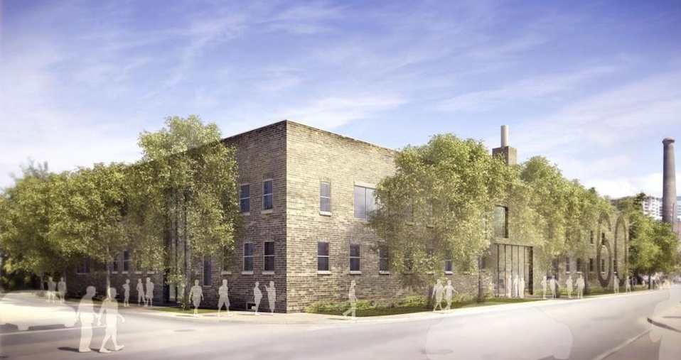
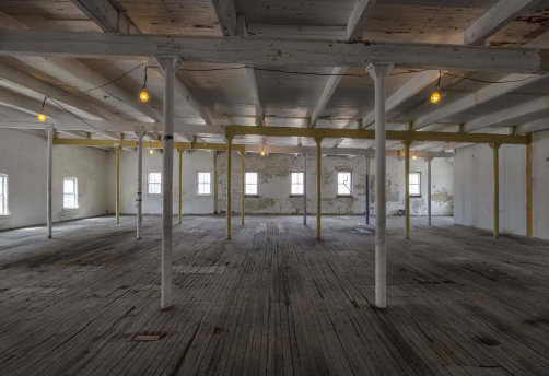
The name ‘Canary’ comes from a restaurant at the gateway to this site. The heritage building (which we are restoring) had a bit of a chequered past. It was a school, then a brothel, and then a greasy spoon called Canary Restaurant that was famous for filmmakers and truckers who would stop in this area.

Existing brick buildings at gateway to the site to be restored.

How will the buildings be repurposed after the Games, as condos and apartments?

Immediately after the Parapan Am Games end in August 2015, the Village is turned back to us and we have the task of taking out temporary dividing walls, painting, putting in the hardwood floors and the kitchens – essentially making the units new again.

The biggest challenge from a post-games constructability standpoint is you don’t have the man and material hoists on the outside of the building so you have to preload and use the elevators as much as possible and optimize material in and waste out. There is a lot of planning going into it; in fact, logistics is the most complicated part.

Rendering of Athletes' Village/Canary District. Image courtesy of architectsAlliance.

This area is considered the largest urban village in the city’s history. How will it be different than another major urban revitalization in Toronto, that of Liberty Village?

This was a very long time in the making. It reflects the thoughtful nature of Waterfront Toronto in terms of community and urban planning, and brings in Jane Jacobs’ principles of liveability and density. You won’t have canyons of glass towers here. It will be a much more liveable environment with the ‘eyes on the street’ concept.

So, in terms of differentiators, first it is the historical/planning context. The genesis is different in Downtown East than Liberty Village in that it involves much more master planning and more heritage elements, being adjacent to the Distillery District, and incorporating the brick buildings at the Cherry Street gateway to this site.

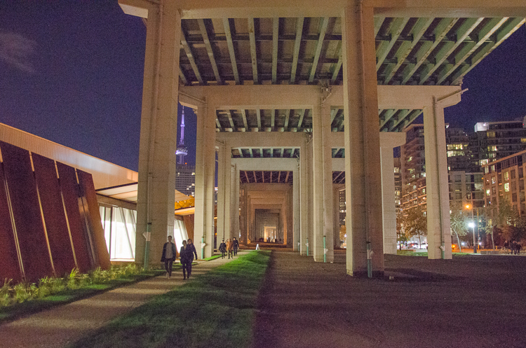
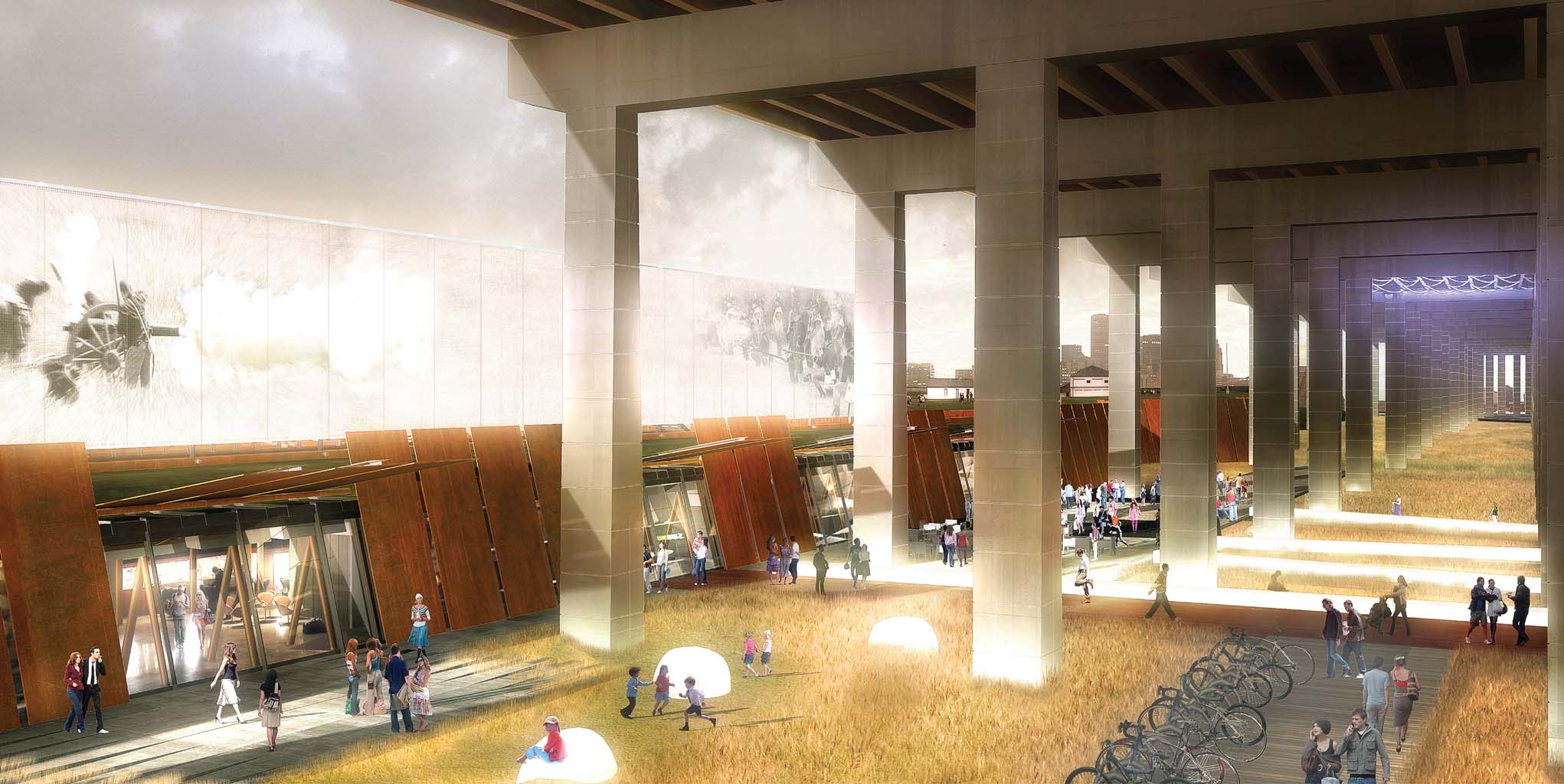
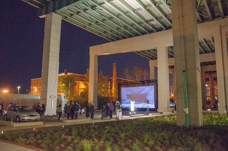
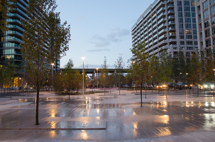
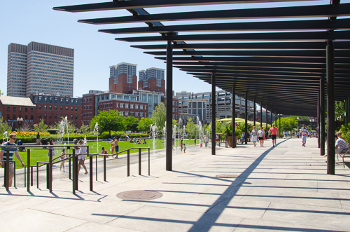
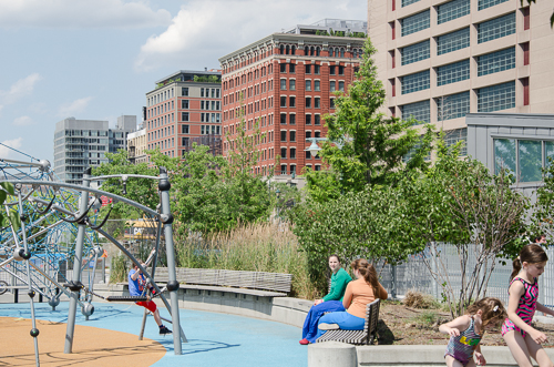
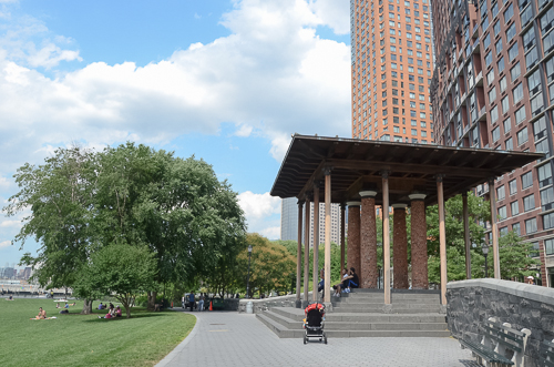
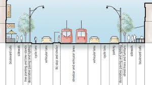
Further, I think the province made a very significant investment in the pubic realm, with the 18-acre Corktown Common park, the linear park (along the Front Street spine through the village), and Underpass Park. A brand new tunnel called the Bala Underpass will allow residents to enter Corktown Common without crossing a road and end up on the Don River Trail system and be able to bike to Edwards Gardens, to Sunnybrook. It is not an 18-acre park you’re adjacent to, but more like an 1800-acre park—through what is Toronto’s greatest natural asset, the ravines—and what many Torontonians don’t really get to appreciate because it’s very difficult to access.

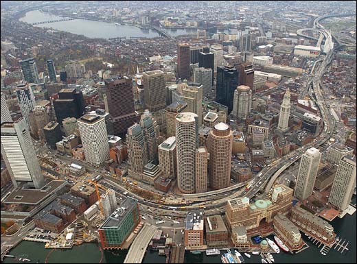
The third differentiator from Liberty Village is the proximity to Downtown. We don’t think about Spadina being equidistant from Yonge as Cherry Street is. Torontonians’ view of Downtown is tilted to the west, and what we see is the Village/Canary District beginning to tilt back to a bit more equilibrium. What we are seeing in real time is just a beautiful evolution happening along those Front Street and King Street corridors.

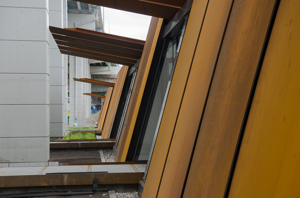
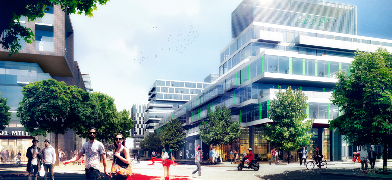
The fourth and final differentiator is the design aesthetic. In addition to public realm piece, what we DundeeKilmer aspire to is the absolute highest level of design excellence. So we brought a team onboard headed by architects Bruce Kuwabara of KPMB and Peter Clewes of architectsAlliance and they in turn recruited a team to create what they called ‘cohesive diversity.’

One element that really excites me is the porous nature of the neighbourhood. The designers were very deliberate in terms of opening the development blocks up to people migrating through them. So, there are laneways that pass through the blocks which is a really nice way to animate the space rather than forcing people to do right angles and walk around buildings, as you have in conventional block development.

Looking east on Canary District site. George Brown College student residence building in the distance.

Does Canary District become an appendage to Downtown or does it co-habit with Downtown with its own identity?

There are no physical barriers to here (e.g. river, expressway) from Downtown. It should become a natural extension of Downtown with a narrative that is very connected to the Don River and Martin Goodman trails. People talk about what makes for a great neighbourhood and I think it’s about diversity of interests, cultures, and economics. And it’s what makes a city great, it’s natural diversity, it’s the ability to transform, invent, and change. The unique challenge here was to deliver an entire neighbourhood and have it feel like a neighbourhood. A lot of thought went into the design, the programming, the unit mix in buildings (1, 2, and 3 bedroom suites), the type of retail and how it’s programmed to have a health and wellness theme that’s complimentary to the Distillery's retail programming.

The masterplan of the community was generated by architects, planners, and Waterfront Toronto. How was LiveWorkLearnPlay engaged here? They have created many villages and recreational places for Intrawest, with precedents like Blue Mountain and Whistler. But that is not the same as a year-round real liveable place?

I think of it as Waterfront Toronto providing the frame and the canvas on which to paint. They defined certain elements for our architectural team to conform to.

LiveWorkLearnPlay is our retail consultant, retail programmers so-to-speak. It’s not in their mandate to shape the urban fabric. They have the task of running a process to populate the retail opportunities within the Canary District under a general theme of health and wellness. Their mandate doesn’t extend beyond essentially animating the storefronts.

What we’ve relied on LiveWorkLearnPlay for is their expertise in creating the balance of a Village and the task of figuring out the right mix between restaurants, retail, and services.

Stephanie Calvet is an architect and a writer specializing in architecture and design. She can be found at www.stephaniecalvet.com

Engineering Greener Development: Bioswales to Bioretention by stephanie calvet

(this is an article I wrote for UrbanToronto) Our climate is changing—our range of weather is getting more extreme—and at the same time we are more aware than ever of our need to use energy wisely. The dramatic environmental, social, and economic consequences related to climate change reinforce the need to plan for energy sustainability in a way that balances growth and environmental integrity.

We have been looking at energy efficient building design initiatives, but it's time we also consider the larger impact of site planning. While UrbanToronto more often looks at high-density development, it is important to remember that building is rapidly taking place in more suburban locations throughout the GTA, where people are seeking larger lots and lower densities. Those communities are always going to be more resource intensive, but there are ways to mitigate that impact, and planners can evaluate how they are designed from an energy perspective. You can achieve savings in a broad sense, for example, by creating communities that are more walkable, simply by virtue of land use planning techniques that concentrate development to reduce the amount of vehicle trips that are necessary to achieve day-to-day needs.

Stormwater management ponds are designed to collect and retain urban stormwater and release it slowly. Photo courtesy of LSRCA.

Municipalities see to issues like stormwater management, low impact development (LID), domestic water savings targets, and master planning that adheres to transit-supportive and walkability guidelines.

Stormwater has become a very serious concern for municipalities. What it really refers to is water balance. By paving over naturalized surfaces and creating more hardscapes, we change the flow of water on a site. This continued paving leads to a cumulative increase in runoff volume and flow duration that results in increased streambank erosion and sedimentation, the risk of flooding, and high concentrations of contaminants. Despite having stormwater controls in place, the health and quality of many urban rivers and streams continues to decline. And if last year’s record rainfall is any indication, climate change only exacerbates the problem.

In 2012, Enbridge Gas Distribution along with Sustainable Buildings Canada launched a green building initiative called Savings By Design (SBD) in response to a mandate of the Ontario Energy Board. The program encourages residential and commercial developers to build more sustainably by providing financial incentives and support for projects that reach an energy reduction target of 25% better than the Ontario Building Code 2012.

While the program is primarily driven by the energy savings of a building, with developers focused on its envelope and HVAC systems, Enbridge's SBD program also works with municipalities to broaden the scope to address the larger site issues.

The pivotal part of SBD is the charrette, an intensive design workshop, which gathers a group of green building experts, engineers, architects and contractors together to evaluate a project proposal in its earliest phase. Through the program’s Integrated Design Process (IDP), the team looks at various solutions and identifies the most effective ways to construct a building for optimum energy performance. When dealing with a larger terrain involving a community or site plan, the group expands to include ecologists, geologists, and planners.

Green landscaping within impervious surfaces, such as parking lots, can help reduce runoff.

We spoke with municipal planning experts who bring a stormwater management and natural heritage protection point of view to the table. They have collaborated with developers and SBD to test out a number of sustainability objectives on projects ranging from industrial lands to residential subdivisions.

Mike Walters, General Manager of the Watershed Management Department at the Lake Simcoe Region Conservation Authority, is dedicated to maintaining and enhancing pre-development hydrologic site conditions. According to Walters, we need to make big changes if we want to achieve our water quality, quantity and aquatic targets and accommodate new urban growth. “It will require more green infrastructure (e.g. LID); new policy, regulation and enforcement; and, exploring other ‘end-of-pipe’ strategies.”

The development industry can benefit from a more integrated, holistic design approach. “Where you’re at in the planning process will impact what you can do,” says Dan Stone, planner and Manager of Economic Development & Sustainability at the Town of East Gwillimbury. Ideally, it is at the very start, at the pre-consultation level, before there is a road network or a plan in place. The collaborative approach taken by SBD contributes toward the design by determining where you can infiltrate and by suggesting street layouts, location of parks, configuration of sidewalks, and how to reduce the amount of impervious area.

Landscaped spaces can transform street surfaces into living stormwater management facilities. Photo by Artful Rainwater Design.

The benefits of the SBD program are numerous. For one, the access to multi-disciplinary specialists who can advise on the design is free (the charrette is paid for by Enbridge). Then, of course, there are incentives if performance standards are met. And, adds Stone, “There is the good press associated with working with the municipality and trying to achieve its sustainability goals; the local community and Councillors appreciate the effort. It’s a completely voluntary program. No risk, no obligation.”

But, the key benefit that resonates most with developers is an approval process that unfolds more smoothly and with fewer surprises. The process is typically lengthy and the development industry is sensitive to that fact: nowhere is the adage ‘Time is money’ more apt.

“The beauty of the IDP is that it puts a lot of good decision making at the front end of the process. You engage with the regulatory authorities early on and get a clear understanding of the municipality’s priorities and a sense of what kind of things are non-starters. You’re giving the proponents the heads up for things to watch out for. That to me, from a municipal planning perspective, is the best value added. Developers can try to perfect their application and get it approved faster – and to market quicker – because they got insights at the very front end,” says Stone.

By implementing Low Impact Development principles, water can be managed in a way that reduces the impact of built areas and promotes the natural movement of it within a watershed. “You’re putting clean water back where it belongs so it can support natural features. This program looks at water not as waste but as a resource, and that’s what I like about it too,” says Walters. But it is more than just applying stormwater Best Management Practices, like vegetated swales, rain gardens, infiltration basins or porous pavers. It requires a change in urban design principles and public acceptance.

“We’ve had developers take innovative steps and risks associated with stormwater management. The environment will win, they will win, the process is quicker, and there is an incentive from Enbridge. What is the downside?” asks Walters.

The industry seems to be responding. “I don’t think the value is from any one individual project,” says Stone. “The value is what the program has been able to add to the whole discussion about sustainable development.”

For more information on the Savings by Design program, visit the website http://www.savingsbydesign.ca/

Stephanie Calvet is an architect and a writer specializing in architecture and design. She can be found at www.stephaniecalvet.com

Brooklyn Community Planning Board Leader Advises Toronto by stephanie calvet

(this is an article I wrote for UrbanToronto) Unprecedented building activity in the GTA coupled with the public’s frustration in engaging the development process is creating a shift towards participatory planning practices. Community Planning Boards may be a way to provide a conduit between the community and city government. The Centre for City Ecology (CCE) invited longtime Brooklyn civic leader Craig Hammerman to discuss the strengths and weaknesses of the Community Board model and provide insight into what might work in Toronto.

For over 20 years, Craig Hammerman has served as District Manager of Community Board 6 (CB 6), a diverse microcosm of NYC that represents 104,000 residents in a medium density community from Park Slope to Columbia Waterfront. He takes great pride in the work he does: empowering residents and advocating for the betterment of his district. Annabel Vaughan, the CCE’s interim director, summoned Hammerman because of his impressive track record. “He has created such a robust dialogue in that the community has a real say in community issues in the neighbourhood,” Vaughan said.

Brooklyn CB 6_rev

NYC is divided into 59 Community Districts. Each has its own distinct Community Board (CB), a concept established in 1975 that enables citizens to play an advisory role in their government. CBs are made up of 50 appointed volunteer board members – caring, committed people who represent a diverse range of perspectives and interests. Although getting a group of 50 to make a decision might seem like 'herding cats', parliamentary procedures in place facilitate the process. The CB hires a District Manager as the agency head and operates with a budget of $200,000 with little room for waste.

Aside from being the voice of their community, CBs monitor the delivery of city services, review land use, and are involved in budget formation. They are extremely effective at identifying capital needs in their districts because members live there and deal with the problems every day. All matters are sorted out in various topical committees (e.g. economic development, transportation, education) that meet monthly and report to the full board.

It is interesting to note how CBs intersect with the government. They are required to review and comment on applications to the Department of City Planning; however, as Hammerman emphasizes, “We are advisors – we make recommendations. We are not in a position to implement anything. We need to be as savvy as we can about influencing the decision-makers – that is really what it comes down to.”

Craig Hammerman photo_rev-2

Some boards are more effective at negotiating and at handling challenges than others. Fortunately, there is a collegiality among them and a sharing of best practices. In order to deal with each large-scale development proposal, CB 6 devised a Responsible Development Policy that is given to the applicant with instructions to address neighbourhood priorities (i.e. environmental standards) before it presents its case at the hearing. “The more we can anticipate, the more we can build into the process,” says Hammerman. Although they try to be proactive in the planning of their neighbourhoods, CBs are often too busy being reactive to the number of applications flooding in. (There are no planners on staff.)

Hammerman is focused on improving the workings of the board by reviewing: composition criteria; recruitment; public awareness and interaction; communication infrastructure; participatory-discretionary budget; funding model; and, a connection to executive branch of city government. More than other districts, CB 6 is taking a creative approach to engage the public by relying increasingly on social media and crowdsourcing, and making available archived webcasts of its meetings.

Something in the process is clearly working. CB 6 saw 2,000 attend a recent community meeting, which shows that as people begin to feel heard, the turnout numbers reflect it.

Community Mtg

There is a recognized disparity across Toronto communities in having their concerns heard at the civic level and being effective in creating change. In some districts, well-organized Resident Associations (e.g. Active 18) proactively weigh in while in others, it is difficult to get input from the local community due to both a lack of expertise and, quite simply, a lack of resident attendance and participation.

Hammerman addressed the group at Urbanspace Gallery, taking questions from an audience that included residents, planners, community activists and legislators. When asked for advice for how we in Toronto can play a more active role in our city’s governance, Hammerman said “Look at how the model of government grew up, where powers are, how decisions are being made, who the players are, and that will give a roadmap to steer where you want to take it.”

Triangles Boards.indd

While there are clear benefits in the nonpartisan Community Board approach, practical considerations aside, it is not obvious how to apply it to what we have in Toronto: a planning system that is largely top-down oriented. NYC has distinct but connected planning entities. Toronto struggles with civil servants who lack influence and the contentious Ontario Municipal Board, which can reverse decisions made by City Council.

While the NYC model is one example, Toronto can draw from jurisdictions around the world. “Having a mechanism that is more transparent and consistent could make the planning process a more positive city building process for everyone involved,” says Vaughan.

In May of this year, Councillor Paul Ainslie [Ward 43] successfully passed a motion to launch a pilot community planning board in the suburban neighbourhood of Scarborough (Kingston-Galloway/Orton Park), an area on the verge of being hit with a wave of new development. The intent is to broaden the impact of participatory planning practices that are already at work in some communities across the city. For more information on The Centre for City Ecology and the pilot project, see cityecology.net. Currently on view at the Urbanspace Gallery is the exhibit UNDER THE TENT Envisioning Neighbourhoods.

60 Atlantic: Converting Liberty Village heritage building for today - Part I: Exteriors by stephanie calvet

(this is an interview I did and article I wrote for UrbanToronto) 60 Atlantic Avenue is a two-storey former industrial building in the west half of Toronto's Liberty Village neighbourhood. Developer Hullmark bought the listed heritage property a couple of years ago and is transforming the outmoded building for today's needs, creating office, retail and restaurant space. UrbanToronto’s Stephanie Calvet sat down with key players Richard Witt and Caroline Robbie of Quadrangle Architects to discuss the 1898 building’s reinvention from both the exterior (Part I) and interior (Part II) perspectives.

urbantoronto-7401-25331

PART I:  Q&A with Architect Richard Witt

The property at 60 Atlantic Avenue is part of a collection of surviving institutional and industrial buildings that give the area its character. What opportunities did restoration of the structure (not strict preservation) vs tearing down and building anew, afford you?

Keeping the building sets up a very different development and value proposition for the site. If it was a new building, it would certainly have been taller, denser and likely not have the same public space that fits neatly into the ‘L’ of the existing building. The existing building’s internal character has a lot of value once stripped out and it is great to see that being restored.

The building does not display a high degree of craftsmanship but it was determined to have design value as an industrial building from the turn of the 20th century and is listed on the City of Toronto Inventory of Heritage Properties. What restrictions were put in place on what you could do here?

Retaining the building is the biggest restriction. The conventional economic wisdom would be to tear it down and put something much larger in its place. For many developers the requirement to retain it would not have been very desirable. Luckily Hullmark sees the value in that character  – economically as well as culturally, ecologically and urbanistically. There was also the requirement for preparation of a Heritage Impact Statement, prepared by heritage consultant Phil Goldsmith, which outlined a number of considerations, including: the important parts of the building (historical entrance, character of the windows) as well as an analysis of the building’s history, which allowed us to have a discussion about which parts of the building did not need to remain.

Screen shot 2013-11-06 at 1.26.01 PM

Since 1991, Artscape occupied the property as its head office with artists' studios. It infused the neighbourhood with energy and played a catalytic role in the reinvention of Liberty Village from a campus of under-utilized industrial buildings to an important cluster of creative sector employment. In which ways do you see this former winery, newly reinvented as a flagship office, having an alternative effect beyond the boundaries of the actual site?

It is not a single tenant building. So far there is one tenant (InViVo Communications) confirmed for the top floor. As far as I’m aware the upper ground level is still available and there are a number of likely candidates circling for the lower ground level. The occupancy of the building will be much greater than it was previously, which is a big contribution to the neighbourhood energy, and the more than one third of the building will be restaurant or retail uses which connect through to new openings on Liberty and Jefferson streets, as well as occupying a new sunken courtyard [see image below] on Atlantic Ave. There will be a lot of two directional traffic in and out of the building, which will have a big effect on the entire area.

Screen shot 2013-11-06 at 1.04.30 PM

For decades, Hullmark focused primarily on large residential developments around the GTA. Recently it has set its sights on transforming neighbourhoods in popular urban areas of the city. What synergies between the two firms make it possible to partner up successfully?

I’ve always liked the simplicity and clarity of a quote by Hullmark founder Murphy Hull “I had a vision. Over time and with hard work that vision came true.” Hullmark’s vision as city builders aligns with something that Quadrangle have been doing for our entire history: taking buildings of latent value and potential and reinventing them as something new and relevant. In addition to 60 Atlantic we are also doing projects of similar objective at 545 King W and 100 Broadview [below]. Hullmark is still doing large residential developments and, under the direction of Jeff Hull, has been transformed into a more urban-focused developer.

100broadview-bldg

If adaptive reuse can be seen as a financially viable style of historic preservation, why aren’t there more enlightened developers in Toronto ready to reclaim historical sites?

There have always been developers doing adaptive reuse in the city. We’ve been working with them for years on projects like City TV, the Candy Factory, the Toy Factory and many others. Although it may be financially viable, it is more work to achieve the same quantity as with a new build. There are always unknowns and surprises along the way and some of those can be expensive. It requires a lot of commitment and long-term vision from the entire team.

What is the interplay between the limitations of zoning (and its revisions) and the requirements of historical preservation? When does one take precedence over the other?

Zoning decisions have the right of appeal at the Ontario Municipal Board, but Heritage Board decisions do not have that same possibility. In the case of 60 Atlantic there was no Site Plan Approval application necessary though, so there was no potential for conflict.

Screen shot 2013-11-06 at 12.58.03 PM

The transparent circulation spine cleverly reveals rather than conceals the existing building behind it. What obstacles had to be overcome and which conditions fulfilled in order to arrive at the solution?

The addition was a means to deliver more regular leasable space and not have to make costly additions to the building to accommodate things like elevators, new plumbing, and adequate structure for heavy mechanical equipment. It is also a way to create a clear difference in expression from the existing and new work. It was easier to do it that way than the alternative. The only real obstacle was matching up to the existing building which is not very regular, and built in phases at different levels.

The building has small punched windows along its façades that lent themselves well to Artscape’s studios and office spaces (and long prior to that, a winery). Are you incorporating larger glazed sections and/or skylights to accommodate the new program’s open plans, and if so, how?

The building was built in two phases, east and west at slightly different heights. The central north south portion was a through-carriageway. Our first objective in working with existing buildings is to understand what is original and what was subsequently added, which in the case of this building was a lot. There were also lots of elements like loading docks, which had been retrofitted as windows with dodgy brick infill. By taking out all of these pieces we were left with a series of large openings, which could be fitted with glazing and become a new layer of expression that more accurately reflects the original condition.

Screen shot 2013-10-22 at 4.11.15 PM

Does this project epitomize Quadrangle’s philosophy of not just locking a building in time but rather adding layers as the city evolves? (i.e. glass is not verboten under heritage conservation guidelines)

The new glazed elements, new circulation, connections to the street on all sides and new sunken courtyard all engage the surrounding community in a way that the building didn’t before. By renovating and turning a former utilitarian warehouse into a vibrant employment and amenity hub, the building both reflects its history and becomes relevant to the future of Liberty Village. So, Yes.

Adaptive reuse is in and of itself a sustainable approach. Are you pursuing LEED certification for this development?

We are not pursuing LEED certification, although we discussed it in the beginning and were conscious of our responsibilities throughout. We reviewed the requirements and did a lot that goes beyond the code requirements including some significantly more advanced mechanical systems. In the end we didn’t pursue it because of the cost of the LEED process itself.

Screen shot 2013-11-06 at 12.06.45 PM

Liberty Village is undergoing a rapid transformation characterized by thousands of new condominiums set amidst historic industrial buildings. Its east side has become, in the words of architectural critic Christopher Hume, “an over-developed condo enclave,” with little consideration to human scale. What would be your advice for city planners or developers to prevent the same saturation on the west side?

The west side of Liberty Village has the opposite problem to the east. It is almost all designated employment lands with a much lower height limit. I think we are moving beyond the days of single occupancy land-based planning (work somewhere, live somewhere else, shop somewhere else, etc.) and there is a lot of discussion about introducing residential permission to this part of Liberty Village. Permitting residential to a maximum as well as a minimum amount of commercial space would be a good way to build a true mixed-use community and encourage the growth of employment simultaneously.

urbantoronto-9122-31497

For 21 years the building was home to Artscape and to 48 affordable artist studio spaces. Not immune to the pressures of the real estate market, the non-profit organization was forced to close this location in 2012. Low cost raw studio space in downtown Toronto is disappearing fast. Can you contemplate ways by which artists and low-profit creative outlets can remain in these neighbourhoods they helped revitalize?

I don’t know if that’s even desirable. I remember that Third Rail art show in Liberty Village when people were living in big warehouses with chemical toilets, and that seems a 100 years ago. Part of being an artist is being ahead of the curve, and once the space around has become popular and mainstream perhaps it is not such a place of creation. Architects have a similar role in residential purchases – a lot of my friends live around Roncesvalles, which was affordable 10 years ago. I don’t think that many architects five years out of university could afford a house there now and where they’re going is probably going to be a great and vibrant area in a few years…

This intervention is simple, sensitive and aware of its context. How do you integrate with the existing fabric of the former industrial precinct while simultaneously anticipating its urban future?

A lot of architectural direction comes from a consideration of broader influences. By looking at the economic patterns of the area, the qualities of the urban context, movement patterns, social activity and a lot more, an obvious design intent reveals itself. Then it is just the business of building articulation. When it comes to making a great city the most important thing is design at an urban level, an understanding of the buildings’ relationship to, and role in, the broader urban fabric. If you have good architects you get beautiful buildings, but that doesn’t make a great city. Ideally you have both, which is what I think we will have at 60 Atlantic.

Stephanie Calvet is an architect and a writer specializing in architecture and design. She can be found at www.stephaniecalvet.com

Architect Craig Webb expands on plans for Mirvish+Gehry Toronto by stephanie calvet

(This is an article I wrote for UrbanToronto) Close to five months since UrbanToronto first broke the story of the extraordinary Mirvish+Gehry development plan for Toronto's Entertainment District, a second public consultation regarding the proposal was held on the evening of Tuesday February 19th at Metro Hall. Hosted by Ward 20 Councillor Adam Vaughan, on hand to give details and answer questions were Craig Webb, representing architect Gehry Partners, Peter Kofman representing developer Projectcore, and owner of the site and driving force behind it, theatre impresario and art collector David Mirvish.

Image

Prior to the presentation, the public had an opportunity to view schematic floor plans, sections, elevations, and a scale model of the proposal within the context of the neighbourhood. Where the first consultation in December introduced the proposal to the public and recorded the resultant concerns of those in attendance, in this meeting Craig Webb opened with a far more detailed account of the plans for the development as they currently stand. He was accompanied by members of the technical team from Gehry Partners and developer Projectcore.

Image

Webb began by expressing the firm's excitement to be working in Toronto again, four years after the completion of the addition to the Art Gallery of Ontario (AGO). Webb reminded the audience of Gehry's subsequently reawakened connection to his hometown and his continued desire to create projects of significance to the city. To provide a glimpse of the working process, Webb showed Gehry's first loose sketch of his vision revealing three towers as very sculptural forms rising from a combined base.

Image

Later in the presentation Webb flashed the image below of a recent model, as he did at the OCAD University announcement the previous week for the Princess of Wales Centre for Visual Arts, and stated "this is where Frank really wants to take the project", no doubt a confounding moment for those straining to understand how the expressive quality captured will translate to a finished building design. The idea is to create podiums with a unified design from which three towers emerge as if from clouds, each with a unique architectural identity.

Image

Webb explained that at the AGO it was important to Gehry to relate that building to the smaller scale of the nearby residential houses, thus that design was scaled horizontally. In contrast, the firm is taking a different approach at this location, sited as it is amongst larger buildings. The team has been looking at how to integrate the scale of the historic city with what's coming in the future, a dilemma that any city builder wrestles with. Toronto has a lot of very tall buildings that are sprouting up right now, but according to Webb, the "interrelation with the street facade is really the key to this project." When studying the existing streetscape, the team identified two key readings: 1) the historic buildings of 4 to 5 storeys establish a lower datum line; while 2) the adjacent Lightbox and similarly tall buildings of 6 to 8 storeys establish a second datum line. The podium height of the new project takes its cue from that second level.

Gehry's office has had what Webb characterizes as vigorous conversations with City Planning about what the King Street 'wall' or 'edge' should be, and about how it should engage the sidewalk. Both sides are working to establish what the goals are for that frontage, in terms of accessibility, openness, and sidewalk width. A partial section through the site (image below) illustrates how the building meets the ground and gives one a sense of the generous sidewalk space that Gehry is trying to achieve. "We really think that the sidewalks need to be widened from what's currently 3-3.5 metres up to 6 metres in some areas so we intend to push the building façades back." The section exceeds City standards in terms of providing an adequate pedestrian zone, a planting zone, as well as additional area which is intended to be used as public gathering space, including restaurant spill-out.

Image

It's this all-important podium that, as Webb describes, "creates edges of the public realm, which creates the cityscape, and which in turn creates neighbourhoods". The strategy that Gehry is taking is to "create a very landscaped and terraced podium to this building. It starts at the street edge and—moving up the building—at the level of the first datum, the building begins to step back, terracing the façade and creating outdoor spaces. We're trying to create a multi-level environment with a lot of public use. The ground level is mainly retail and restaurant spaces, and those public spaces will step up across the terraces, bringing people higher up into the building. Instead of being a single layer of public uses, we're expanding it vertically."

"We intend to undulate the building façade back and forth so that it's not just a straight, street wall, but it has some relief to it and has pockets where restaurants are expected." The images below are of gestural models used by the firm as a starting point to understand the architectural flow and movement of the building. "The intention is to create a lot of transparency, colour, graphic, and excitement."

Image

When it was first revealed in the fall, the model above ellicited some groans from those who misunderstood its intent and were not able to see beyond what they perceived as "toilet paper" adorning it. In the model below a potential treatment of the podium is more developed. Webb expects many more models will be created before a final plan is formulated.

Image

Webb emphasized that although the models do not represent a finished design, the interior designs are further along than a massing study. They have been worked out very carefully in terms of structure, elevator core servicing, and even preliminary suite layouts.

Webb walked the audience through the floor plans, beginning with the ground level plan, pictured below. "Our intent is to activate all four sides of the site." Instead of merely relying on bustling King Street, the team feels there are advantages to putting retail frontages on the more intimate side streets as well.

Below, retail space is indicated in blue, while the residential lobby components, whose 'front door address' Gehry feels is more appropriately suited to the smaller streets, is orange. Loading and parking access is shown in brown, while commercial office entry areas appear in red. OCAD U's entrance, shown in yellow, is on Duncan Street, the school's main south campus artery, while direct street access to the Mirvish Collection is indicated in green from Pearl Street.

Image

The podium itself is 6 storeys in height and retail and restaurant spaces wrap the lower 3 floors. Creating a diagonal connection through the project site between King and John streets is a public arcade access that will climb from street level via stairways and escalators, and culminate on the 3rd floor. The street level lobbies to the upper level retail areas are indicated in light blue in the image above.

Image

Level 2 is programmed with more retail and an atrium space that connects to the floor below. In addition, a restaurant with terrace is envisioned on the NW corner, overlooking what the City is planning as the 'John Street Cultural Corridor.'

Image

Active public uses and landscaped south-facing terraces continue on the 3rd floor, with the first section of the extensive, 3-storey Mirvish art collection, also beginning here. OCAD U’s expanded facilities, organized on two floors in the Phase 1/easterly tower, include a faculty exhibition space here on level 3, and the art instruction and studio space on level 4.

Image

Some commercial office space is planned for the podiums on levels 4, 5, and 6, and it can be seen in red above and below. The Mirvish Collection galleries continue on these levels as well.

Image

Image

Image

A residential terrace, with outdoor amenity and garden space of varying sizes and orientations, are provided on top of both podiums at the 7th level. Residential indoor amenities, which can open to the exterior, are also situated here. Condominium units rise on the floors above, with the towers at 82, 84, and 86 storeys. The unit count is approximately 2700, but that will likely change as the layouts are developed, and around 300 parking spaces are currently proposed.

Webb ended his presentation saying "When we started the project, David Mirvish asked Frank to create three great sculptures for the skyline of Toronto. That's what we intend to do. We're not there yet but we're going to rise to the challenge."

‘WALK IT OUT’ – A panel discussion with Toronto’s chief city planner by stephanie calvet

Urban Toronto_Walking-3 Public conversations about city building are taking place in Canada’s largest urban centre. Most recently, one panel, engaging parents, child educators, heath professionals and big city-thinkers, aims to create a healthier, more walkable Toronto for children.

University of Toronto’s Faculty of Kinesiology & Physical Education hosted “What Happened to Walking?” – Encouraging active school travel in Toronto. Professors on the panel shared their research findings from the ongoing BEAT project (Built Environment and Active Transport), which studies the topic from multiple perspectives: physical and mental health; financial costs; urban landscapes; and, the child’s point of view (including fears, obstacles). While within certain distances walking is still the most common mode, it has been on the decline and children are heavier and weaker than ever.

Urban Toronto_Walking

The evening’s keynote speaker Jennifer Keesmaat emphasized the importance of this simple and meaningful childhood experience rooted in nostalgia. Who doesn’t have stories about walking to/from school, or about exploring one’s surroundings while dillydallying on the way home? The symposium was one of the first opportunities to hear from the newly-appointed chief planner for the City of Toronto.

Keesmaat, an approachable young urbanist (and mother), claims that by having vastly separated our uses (read: sprawl) and privileging moving vehicles, “children have been designed out of public space.” Predominantly driving environments, with their countless turning lanes and blank façades, are unworthy of children’s curiosity. They are isolated, unsafe, and unfriendly for anyone, much less kids! Walking is more imperative than ever and our immediate surroundings need to be more conducive to travel on foot.

In light of the city’s unprecedented growth (Toronto is the condo epicentre) and staggering infrastructure deficits, are we, maybe, at the cusp of a change? A new theory entitled ‘Peak-Car’* suggests that in various cities of the world we are witnessing an aggregate levelling off in average car mileage perhaps the result of car saturation and changing mobility patterns: fewer people owning cars, walking more.

And while the Greater Toronto Area (GTA) is investing significantly in regional transportation, Keesmaat stresses the need to “create places where we see walking as a fundamental part of our transportation planning.” We can support a walking culture by giving pedestrians priority, not only by providing safer circulation but also by thinking about “how we embody a space and a place”. There is strong local support for developing denser, sustainable, walkable neighbourhoods near shops and services, and a desire to move away from car-centric environments.

Urban Toronto_Avenues

The City has identified key avenues (above) to cultivate as "walking habitats" – attractive, all-season pathways characterized by wide sidewalks and buffers, greenery, and buildings that don’t overwhelm the street and that allow sunlight to hit the pedestrian realm. Creating environments where everyone can share in a high quality of life, and building neighbourhoods and walking habitats that are supported by great public transit and cycling networks is really, as Keesmaat says, “an equality and justice issue.” And while infrastructure presents its challenges, she iterates that the way to ultimately increase healthy modes of commuting begins, you guessed it, with parents.

Moderating the panel discussion, Christopher Hume, an outspoken architecture critic and urban issues columnist of the Toronto Star, remarked on the irony that “we have to argue for walking”, and the fact that “we have to devise policies” to make this most basic of human functions possible.

Although the focus of the talk was on how to promote greater independent mobility among children, it shifted to the functioning of the built environment as a whole and the larger issue of how citizens relate to the city. Hume criticizes the motorized-mindset and states that the ambivalence we’ve shown is a “reflection of how we feel about the environment in which we live. We cannot afford convenience any longer.” If we truly believe that cities should be designed for people, it will require making cultural choices and hard sacrifices in order to reclaim the streetscape and re-design it to be shared amongst people and cars.

Never has the job of planners been more important. If in fact true, the underlying principles of ‘Peak-Car’ give practitioners “much more freedom to think about what kind of cities they want.”* They curate a set of design guidelines and best practices that can be integrated into policy in order to encourage more healthy use of public spaces like streets and sidewalks. Toronto has plenty of precedents to learn from...

Street Section_1

images-2

To see this public speakers’ series lecture, click here.                                     *Toronto Chief Planner Jennifer Keesmaat made reference to a London Times article on ‘Peak-Car theory’.  See her official blog at http://ownyourcity.ca/

Heritage Architect Julian Smith on ‘Re-imagining the historic urban landscape’ by stephanie calvet

“What gives a physical place meaning? How do we decide which historic sites are culturally significant?” Cultural Landscape theory is an attempt to provide new answers to these often-debated questions. It emphasizes that the traditional distinction between the physical and the cultural landscapes is an artificial one and that nature and culture should not be seen as conflicting but rather as part of an all-encompassing ecosystem, a vision not unlike that held by indigenous communities. In such a view, human habitats display the diversity and richness of their different cultural subgroups and achieve a sustainable equilibrium with their environment.

As part of an ongoing series of talks, Toronto’s Centre for City Ecology recently invited leading heritage architect and educator Julian Smith to give a lecture entitled ‘Re-imagining the historic urban landscape ’ in which he explores the meaning of cultural landscape and how we create it in our communities. Smith has established an international reputation for his work in the conservation, restoration and adaptive reuse of historic properties, and cooperates with UNESCO and the World Bank, but his most challenging role is as Executive Director at Willowbank, an educational institution “at the cutting edge of a global shift towards a more ecological and sustainable approach to heritage conservation.”

Willowbank promotes cultural heritage and emphasizes the apprenticeship tradition (hands-on craft skills). In addressing Willowbank’s approach to the historic urban landscape, Smith prefaces with the distinction between historical landscapes, which have prior historic significance and can be observed, and cultural landscapes, which exist in the cultural imagination and have to be experienced to be understood.

Smith summarizes a 300-year history of motivations for Conservation into four biases: Antiquarian – the archaeologist spins great stories about culture from physical remnants of earlier civilizations; Commemorative – the historian protects and tells the story of the historic place through reconstructions or ‘stage sets’; Aesthetic – the architect/architectural historian recreates heritage vocabulary (think Colonial Williamsburg-inspired wallpaper); and, most recently, the Ecological bias that emphasizes a more holistic view of the interconnectedness of buildings/landscapes/artefacts as way of understanding the world whereas earlier biases expressly used the ‘object’ in isolation. This 21st century approach is based on the notion that artefact and ritual come together to create cultural reality.

When we talk about how communities understand place we are dealing with perceived realities, which consider the cultural landscape, not actual or physical reality, i.e. GIS map. Rituals map the city. Case in point: everyone in the audience was instructed to map a small common section of Toronto (an exercise Smith often has students do). The results typically demonstrate that when people think of cities, they plot their rituals, such as commute, festivals, or processions.

“One of the great things about cities is that you can have cultural landscapes that overlay each other and multiple cultural realities existing in the same place.” Smith cites a number of local examples of these places of overlap which frequently are the most fascinating parts of cities: Boulevard St. Laurent, a commercial and multicultural artery in Montreal; or, Kensington Market, a distinctive neighbourhood in downtown Toronto with an unpretentious, bohemian-esque vibe. In the latter’s case, nothing evolved according to planning principles but was rather the result of a pattern of (illegal) unregulated activity and that is precisely what gives this area its vitality. Smith thinks this part of the city deserves recognition as a cultural landscape that overrides both the province’s Planning Act and Heritage Act and needs to be protected as such.

Smith highlights Evergreen Brickworks, an innovative multi-use community environmental centre housed in a series of heritage buildings that successfully blur the boundaries between public and private spaces. He argues that architects/planners have been limited by architectural constraints or relied too long on property lines and rights when thinking of how we occupy the city. “Planners are still groping with what it means to lose those distinctions. Our approach has become so aesthetic and commemorative,” says Smith. “You have to maintain cultural landscapes of city layered on top of each other (otherwise you gentrify).” We need creative thinking; a dynamic definition of cultural change; and, to allow the evolution of buildings and places with contemporary layers such that they are in harmony, and not just freeze them in historic settings.

This type of discussion is particularly interesting for a dynamic environment like Toronto that is growing and changing at a rapid pace by virtue of the constant influx of people. It seems that only by integrating commerce, culture and community can we achieve a balance between urban growth and quality of life on a sustainable basis. The Centre for City Ecology, whose mandate is to “raise levels of urban literacy so that ordinary Torontonians can join in a robust conversation about city building,” engages the community to create meaningful spaces for a more liveable city. It hosts lectures at the Urbanspace Gallery at 401 Richmond St West, a heritage building providing spaces for the creative sector.

For more information on the lecture series, check the CCE's website http://www.cityecology.net/. Click here to see the video of Julian Smith’s November 14 presentation. 

World Town Planning Day 2012 by stephanie calvet

From CIP website:  "World Town Planning Day is currently celebrated in some manner in about 30 countries on four continents. To celebrate this international event held annually on November 8th, the Canadian Institute of Planners (CIP) and its affiliates distribute e-Posters to members across the country and to organizations around the world." For the fourth year in a row, the collaboration of a growing list of planning organizations – from Australia, Canada, South Africa, UK, USA, New Zealand – continues to support a joint “virtual” conference for planners from around the globe in honour of World Town Planning Day. The conference takes place on November 6 - 7, 2012 and is completely online, as a part of an effort to reduce the carbon footprint caused by presenter/participant travel.

"The international organization for World Town Planning Day was founded in 1949 by the late Professor Carlos Maria della Paolera of the University of Buenos Aires to advance public and professional interest in planning, both locally and overseas. WTPD is promoted each year by the International Society of City and Regional Planners (ISoCaRP) headquartered at The Hague, The Netherlands."

This year’s conference brings together leading practitioners and experts on the topic “Smart Communities Connect.” The purpose of this conference is to hear ideas from around the world on how we are planning for mobility and how new technologies – like mobile apps and other smart solutions – impact planning. Download the programme or visit the conference's dedicated website.